
Hurricane Milton, a powerful Category 5 storm that eventually made landfall in Florida as a Category 3, represents yet another grim testament to the evolving nature of extreme weather events in the context of climate change. From its explosive intensification to its catastrophic impacts, Milton is the latest in a string of weather phenomena that underline the increasing frequency and intensity of tropical cyclones globally. This storm’s rapid development was a fluke and a complex interplay of atmospheric and oceanic conditions influenced by broader climatic patterns such as the El Niño Southern Oscillation (ENSO).
The Genesis and Escalation of Hurricane Milton
Milton began as a modest tropical depression in the central Gulf of Mexico. It seemed unremarkable initially, but meteorologists quickly noted that the storm was sitting atop abnormally warm sea surface temperatures, some of the highest recorded in the region for this time of year. This excess heat gave the storm ample energy, allowing it to undergo what scientists call “explosive intensification.” Within just 24 hours, Milton accelerated from a Category 1 to a devastating Category 5 hurricane, with peak sustained winds of 290 km/h.
This rapid strengthening was due in part to the current ENSO state. The tropical Pacific is transitioning towards a La Niña phase, typically reducing vertical wind shear in the Atlantic. This critical factor allows hurricanes to grow unimpeded. During La Niña periods, atmospheric instability increases, promoting the formation of stronger cyclones. This exact mechanism that fuelled Milton has been implicated in other extreme weather events across different regions, including the Mediterranean.
The Impact: From a Catastrophic Category 5 to a Deadly Category 3
As Milton closed in on the Florida coast, it encountered cooler waters and increased wind shear, causing it to weaken slightly to a Category 3 hurricane. Nevertheless, it made landfall near Siesta Key with maximum sustained winds of 195 km/h, generating storm surges up to 15 feet in some areas and unleashing torrents of rain. The National Hurricane Center warned residents not to be deceived by this apparent weakening. “Just because the winds dropped doesn’t mean the danger has lessened,” noted Ken Graham, Director of the National Weather Service, in a press briefing.
Milton’s landfall caused widespread devastation in Sarasota and the greater Tampa Bay area. Roofs were torn from homes, streets were submerged, and entire communities were left without power. Emergency services were paralysed in Pasco County, and evacuations became impossible as roads transformed into rivers. The combined effect of Milton’s winds, rain, and surge prompted over two million people to flee their homes in recent years in Florida’s most extensive evacuation effort.
Tornadoes and the Trail of Destruction
Milton did not just bring high winds and flooding. It also spawned a series of destructive tornadoes, which tore through the already devastated landscape, exacerbating the destruction. One particularly violent tornado crossed Interstate 75 near the Miccosukee Service Plaza, ripping through vehicles and infrastructure. Tornado activity of this intensity is rare in hurricanes. Still, Milton’s structure and the local environmental conditions made it particularly prone to producing these secondary disasters.
Local authorities reported dozens of injuries and at least 15 confirmed fatalities in the immediate aftermath of the storm. Entire neighbourhoods were flattened, and it is feared that the total human toll may rise as search and rescue teams gain access to the hardest-hit areas. The Federal Emergency Management Agency (FEMA) was mobilised alongside the National Guard and Coast Guard, deploying over 5,000 personnel to assist with recovery efforts. President Biden and Vice President Harris personally addressed the nation, urging affected communities to seek safety and promising that federal resources would be available to support the ongoing relief operations.
The ENSO Connection: A Global Phenomenon with Local Impacts
Milton’s rapid intensification and subsequent weakening are a case study of how ENSO can influence the behaviour of tropical cyclones. While the Atlantic has been experiencing reduced wind shear due to the developing La Niña, other parts of the world, particularly the Mediterranean, have been grappling with more erratic storm patterns. Last year alone, the Mediterranean region saw two major cyclonic storms, Helios and Daniel, which caused widespread damage across southern Europe.
A Mediterranean Parallel: Helios and Daniel
In comparison to Hurricane Milton, the Mediterranean storms were smaller in scale but equally destructive. Storm Helios struck the southern Italian coastline and Malta with winds exceeding 145 km/h and heavy rainfall, leading to catastrophic flooding in several provinces. The Research Innovation Unit estimated that throughout the night between the 9th and 10th of February 2023, Helios poured over 32.5 billion litres of rainwater on Malta. Similarly, Storm Daniel battered the Greek islands, causing extensive coastal erosion, skimmed Malta, and making landfall in Libya, inundating low-lying areas that claimed the lives of over 20,000 people. While these storms did not reach the intensity of their Atlantic counterparts, they are becoming increasingly common, underscoring the Mediterranean’s growing vulnerability to extreme weather.
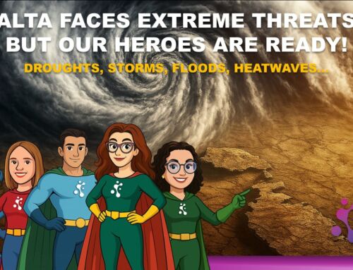
The Mediterranean is traditionally considered less prone to tropical cyclones. Still, rising sea surface temperatures and changes in atmospheric circulation, partially influenced by ENSO, alter this historical pattern. Malta, situated at the heart of the Mediterranean, is at particular risk due to its small landmass and proximity to significant storm tracks. As sea temperatures continue to rise, the island could see more frequent and intense storms in the coming years, posing a considerable threat to its infrastructure and population.
In the next part of this editorial, we’ll explore the broader implications of Hurricane Milton for global climate adaptation strategies and delve deeper into the challenges faced by Mediterranean nations like Malta in preparing for a future shaped by more frequent extreme weather events.

