July 2022 marked the start of the Tree Inventory within the locality of Gzira, Malta. This locality-wide inventory of trees is a first for Malta, a great initiative conceived and undertaken by the team of the Research Innovation Unit whilst threading the record-setting extreme heatwave that affected most of the globe.
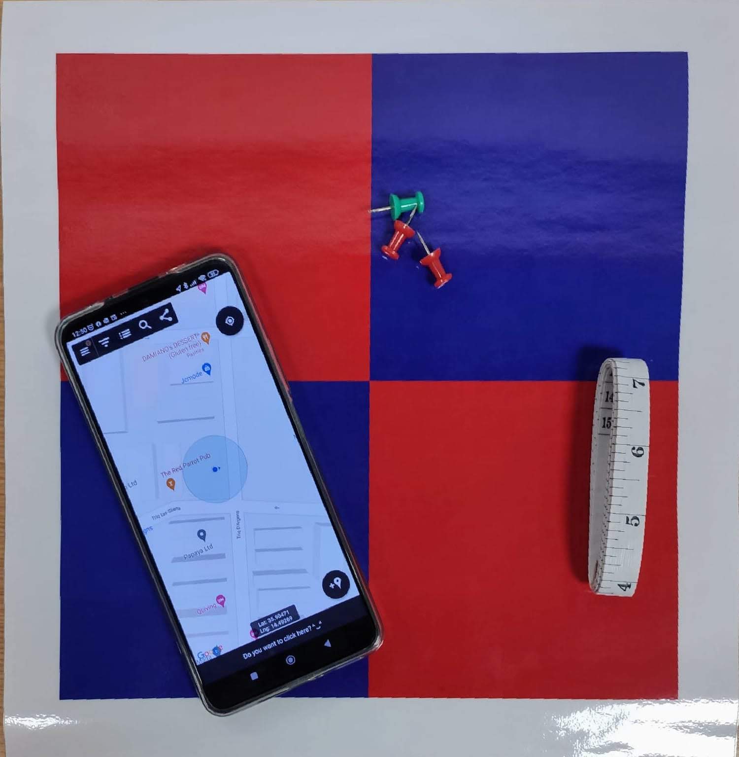
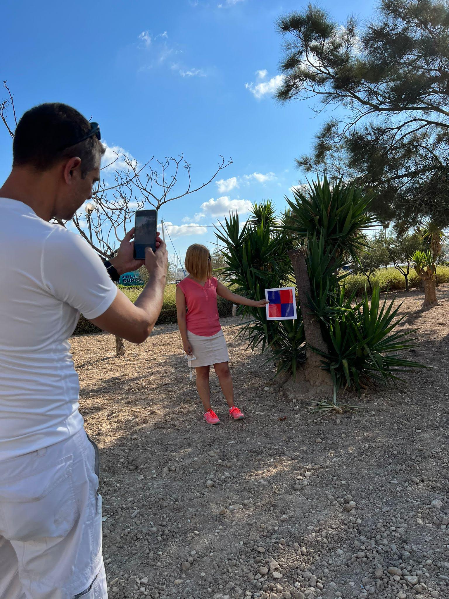
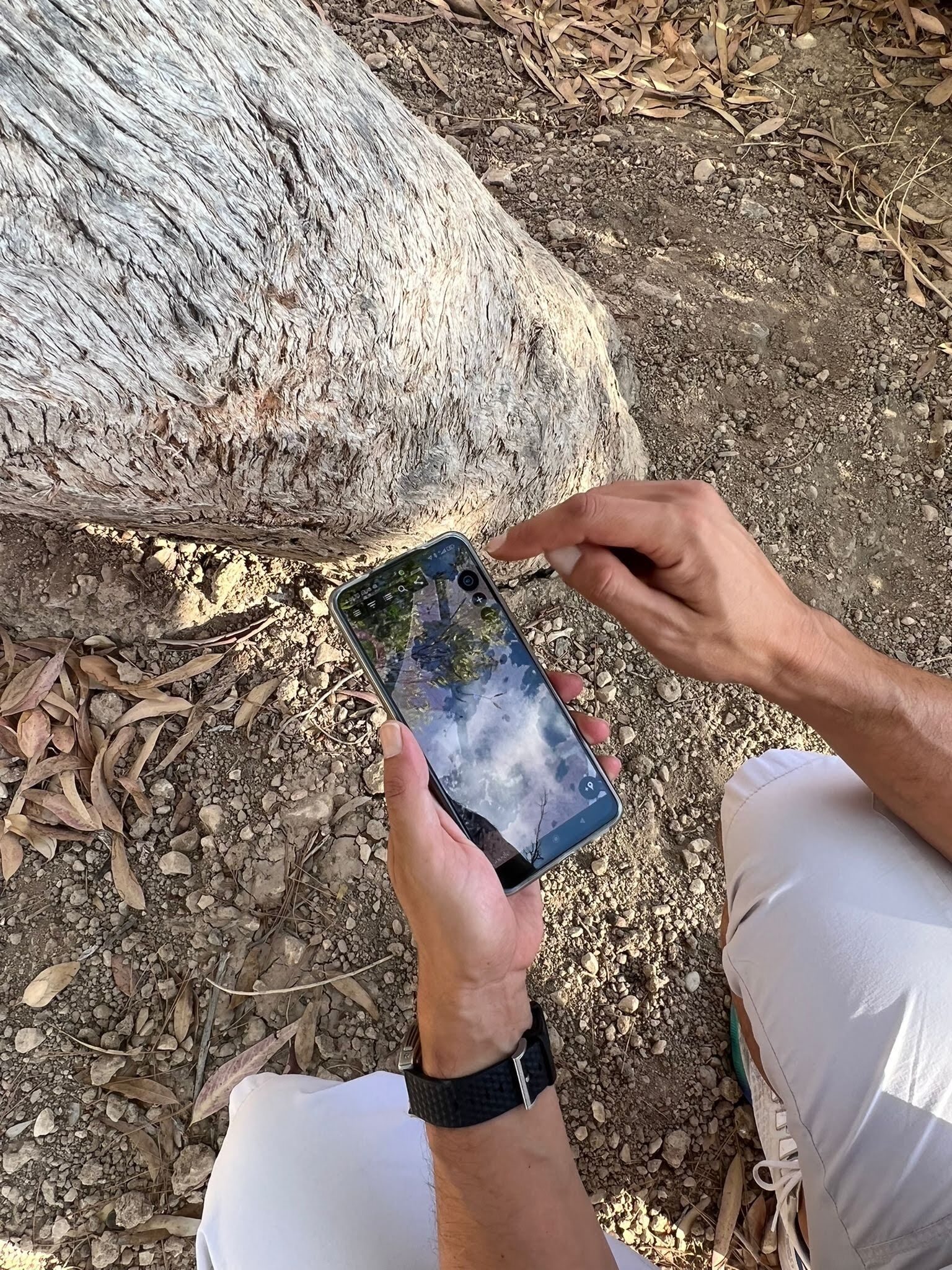
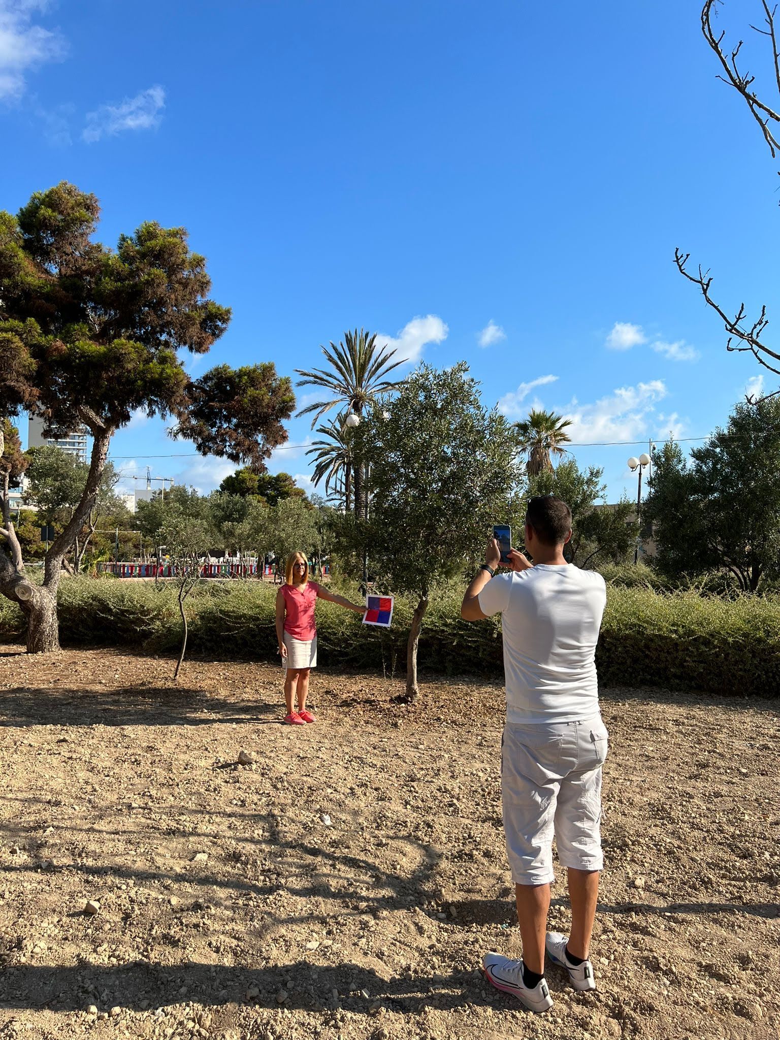
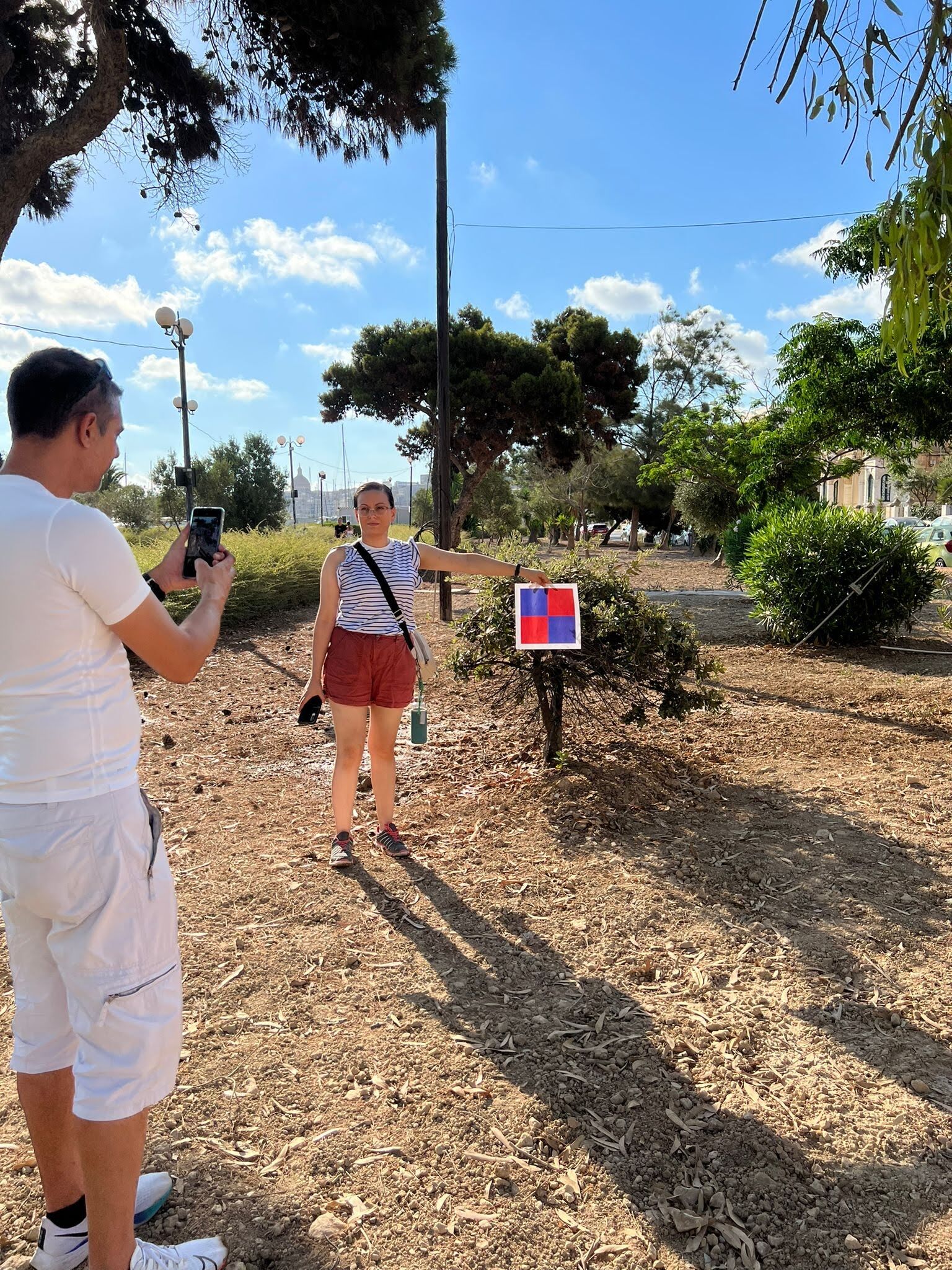
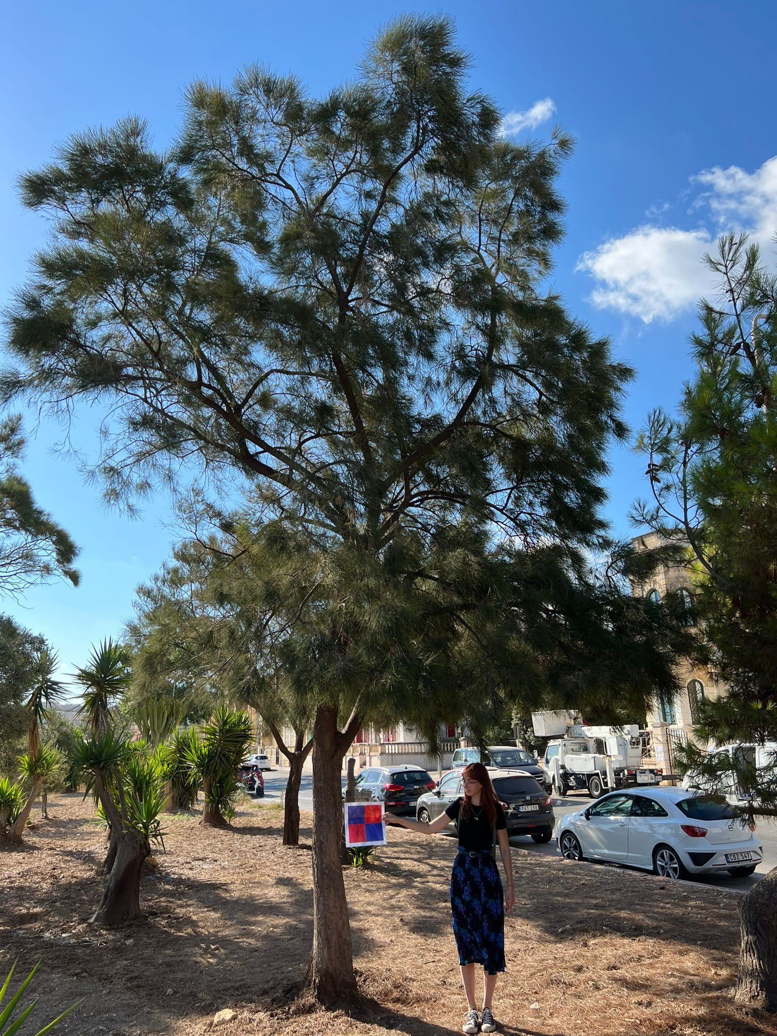
The Research Innovation Unit created a straightforward and fast fieldwork solution to aid and expedite the inventory data acquisition. A simple survey reference scale and a fabric measuring tape are the primary tools for the job, coupled with using two free mobile applications installed on a smartphone with a data connection.
“Pollution levels in Gzira well exceed the maximum recommended levels by the World Health Organisation (WHO) and the European Environment Agency (EEA). We need to know our existing trees and implement much more. Let’s establish a cross-sectoral tree culture.”
The scope of adopting a simple fieldwork approach is to act as a multiplier effect and inspire the uptake by the public, voluntary organisations, and students from middle to senior schools in Malta. Student uptake is our primary goal as RIU strongly believes in empowering the younger generations into mainstream climate action.
Despite the simplicity, this inventory method uses a precise hybrid GPS, GLONASS, geospatial mapping technology, cellular data positioning, and artificial intelligence (AI).
Why are tree inventories of importance? We are all familiar with the term green lung; just like climate change, climate crises, global warming, etc., the green lung has been tattooed on our frontal lobe dues to the expanses of awareness campaigns. Trees as nature-based solutions provide the countermeasure to the extensive pollution and resulting extreme climate scenarios we face today. Through tree inventories, we can gauge tree benefits in the sorts of:
- Carbon Dioxide sequestration and storage through photosynthesis
- Hydrology effects (storm water run-offs, interception)
- Natural shade areas
- Absorption of ultraviolet radiation (UV)
- Cooling effect due to transpiration
- Human health impacts both physical and psychological
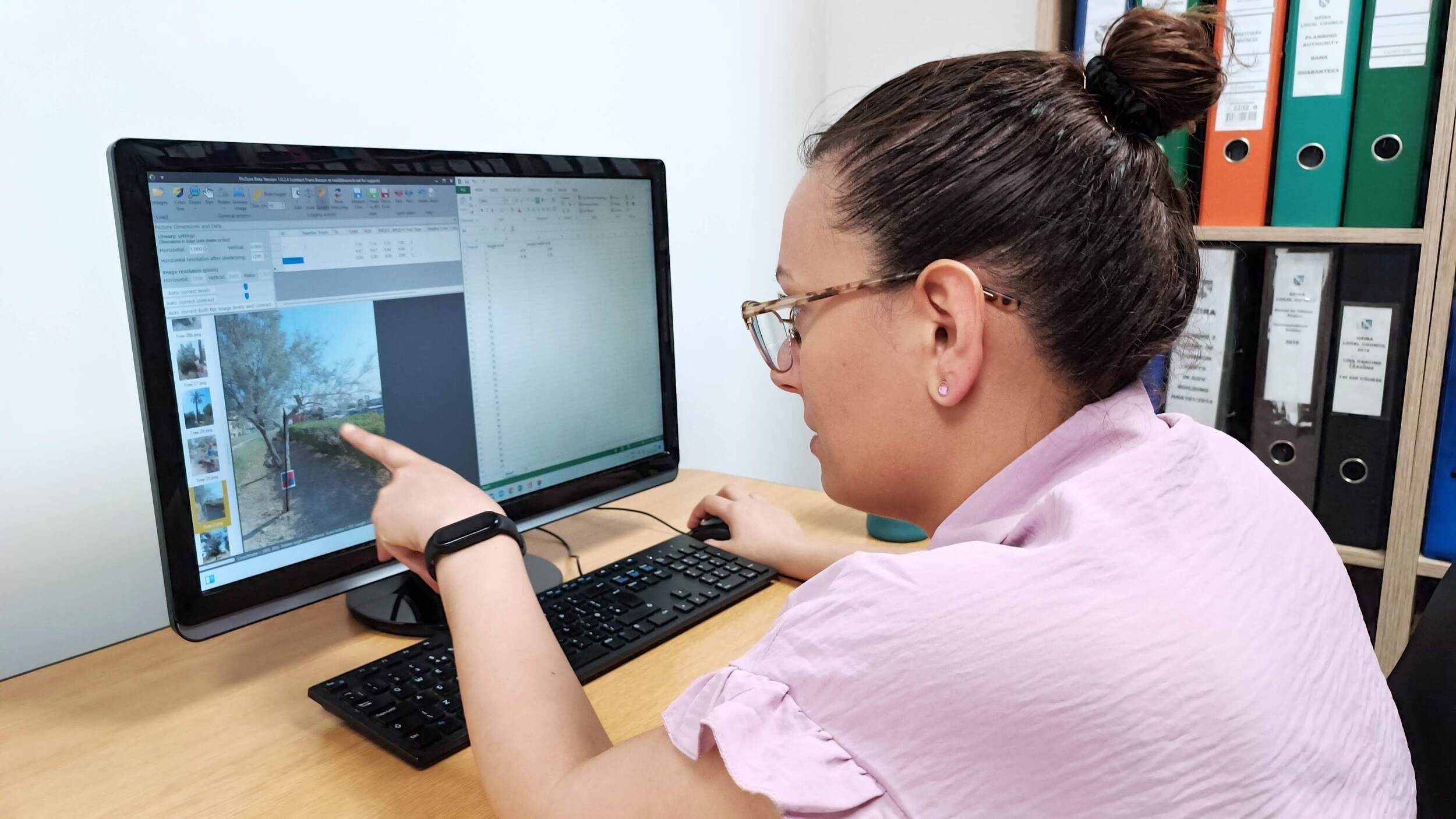
Post fieldwork
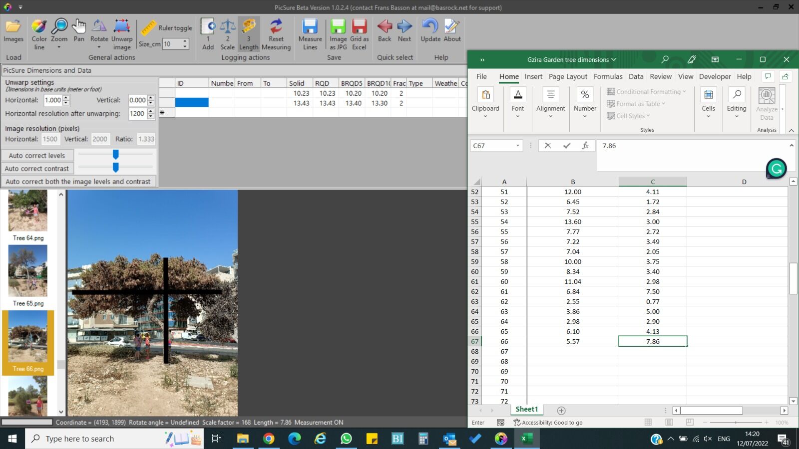
Past the fieldwork data acquisition, the team at the Research Innovation Unit starts compiling data to formulate proper geospatial data from KMZ files as follows:
- Field acquired tree location in terms of longitude, latitude, and altitude
- Field acquired tree type – species of the tree (scientific and common name)
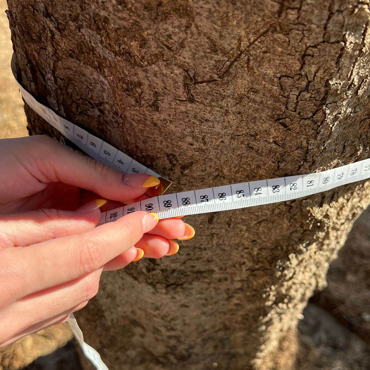
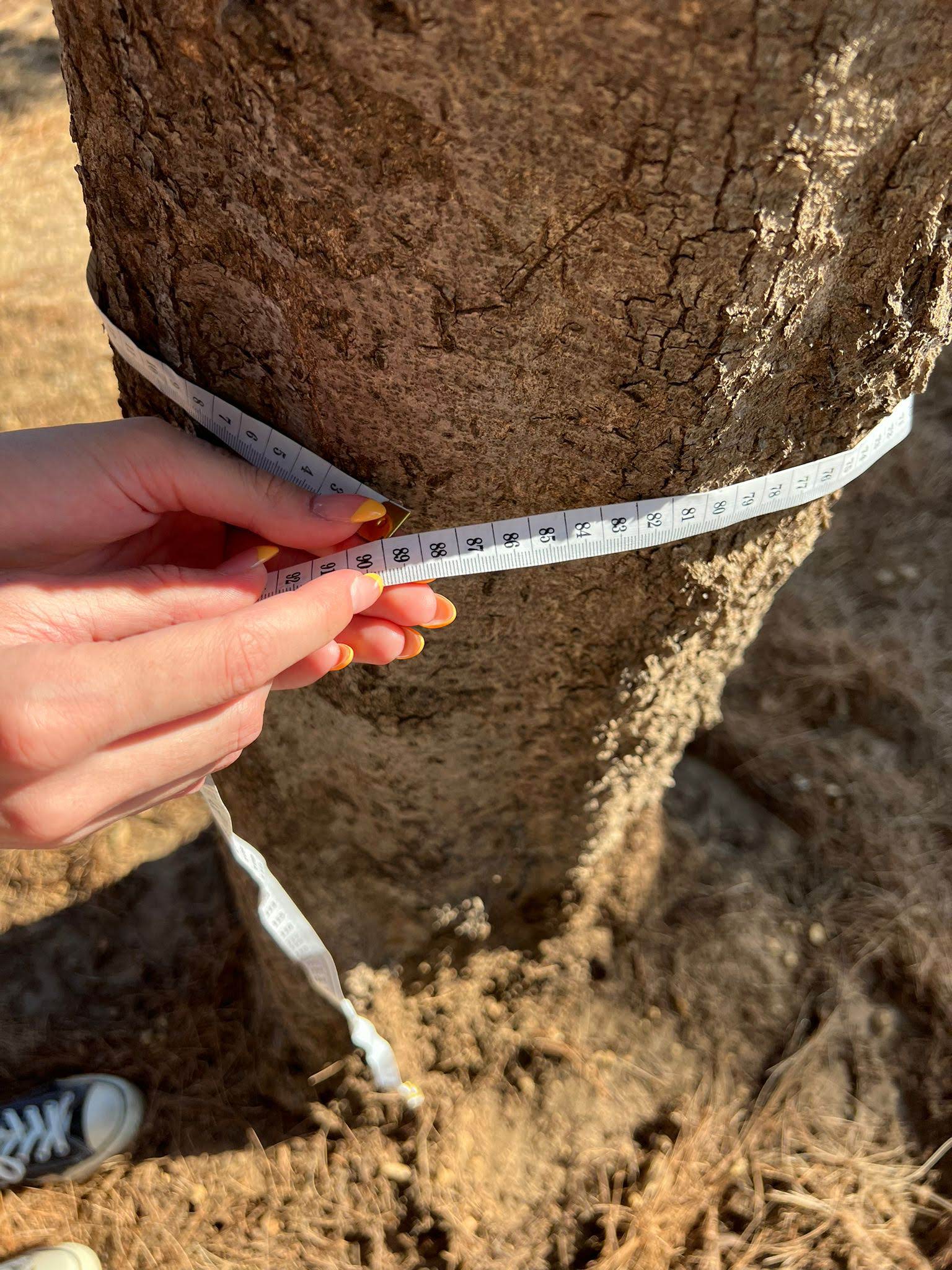
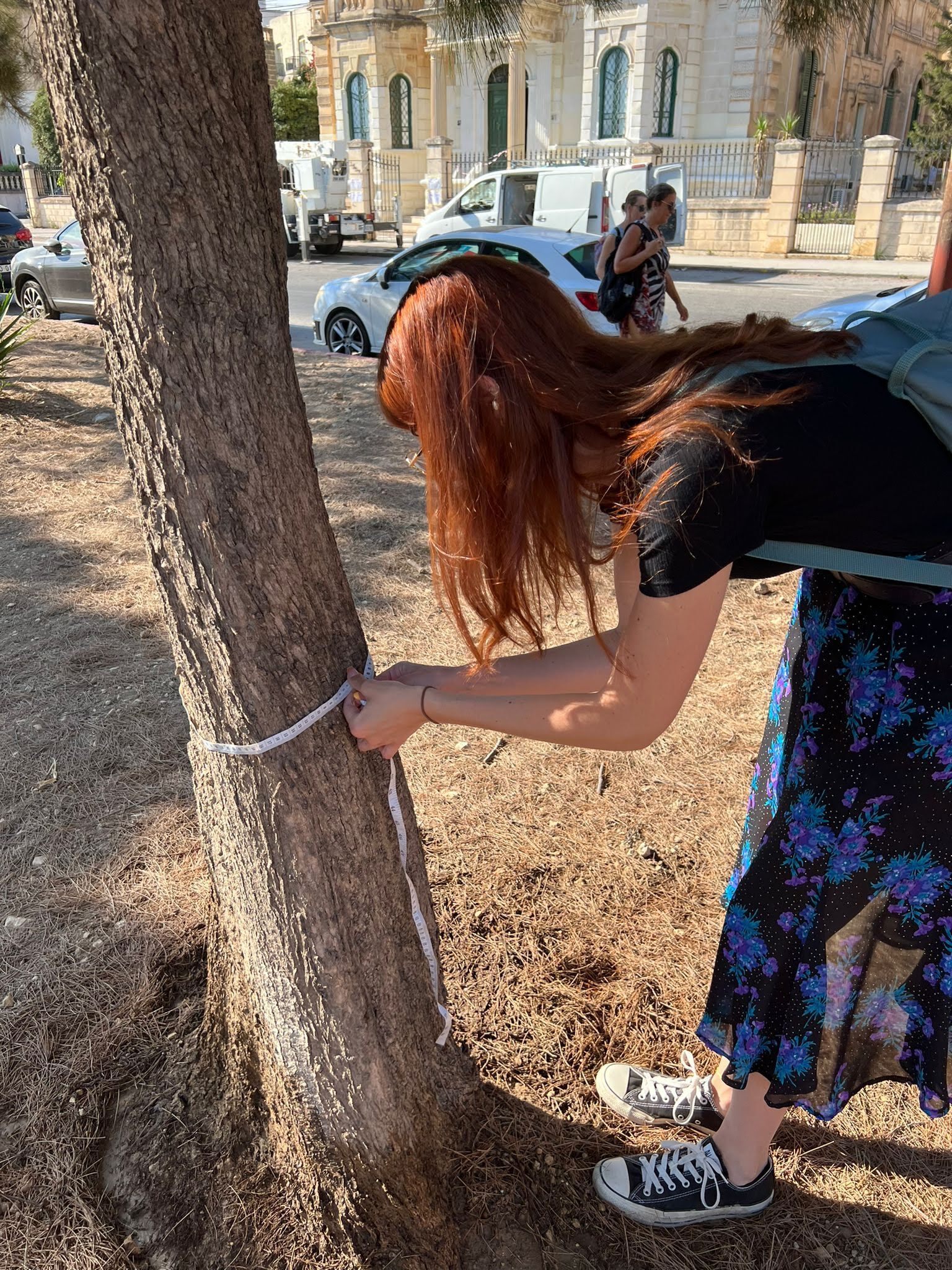
- Field acquired tree trunk circumference
- Field acquired tree image with a survey reference scale
Using photogrammetry and AI-powered software we can calculate by using the reference scale the:
- Exact height of the tree
- The width and surface area of the tree canopy
- The Vegetation Index (the status of the tree leave cover)
Using trunk circumference (diameter = Circumference / π) and the optional tree height, we may attempt to calculate an approximation of the age of the tree in a non-intrusive or destructive way.
We aim to provide a GIS file free of charge from our website once the data is completed.

This project has received funding from the European Union’s Horizon 2020 Innovation action programme under grant agreement no. 101003757

