window.dataLayer = window.dataLayer || []; function gtag(){dataLayer.push(arguments);} gtag('js', new Date());gtag('config', 'G-X3B6KTR0LP');

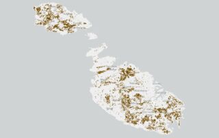
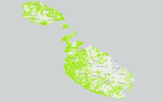
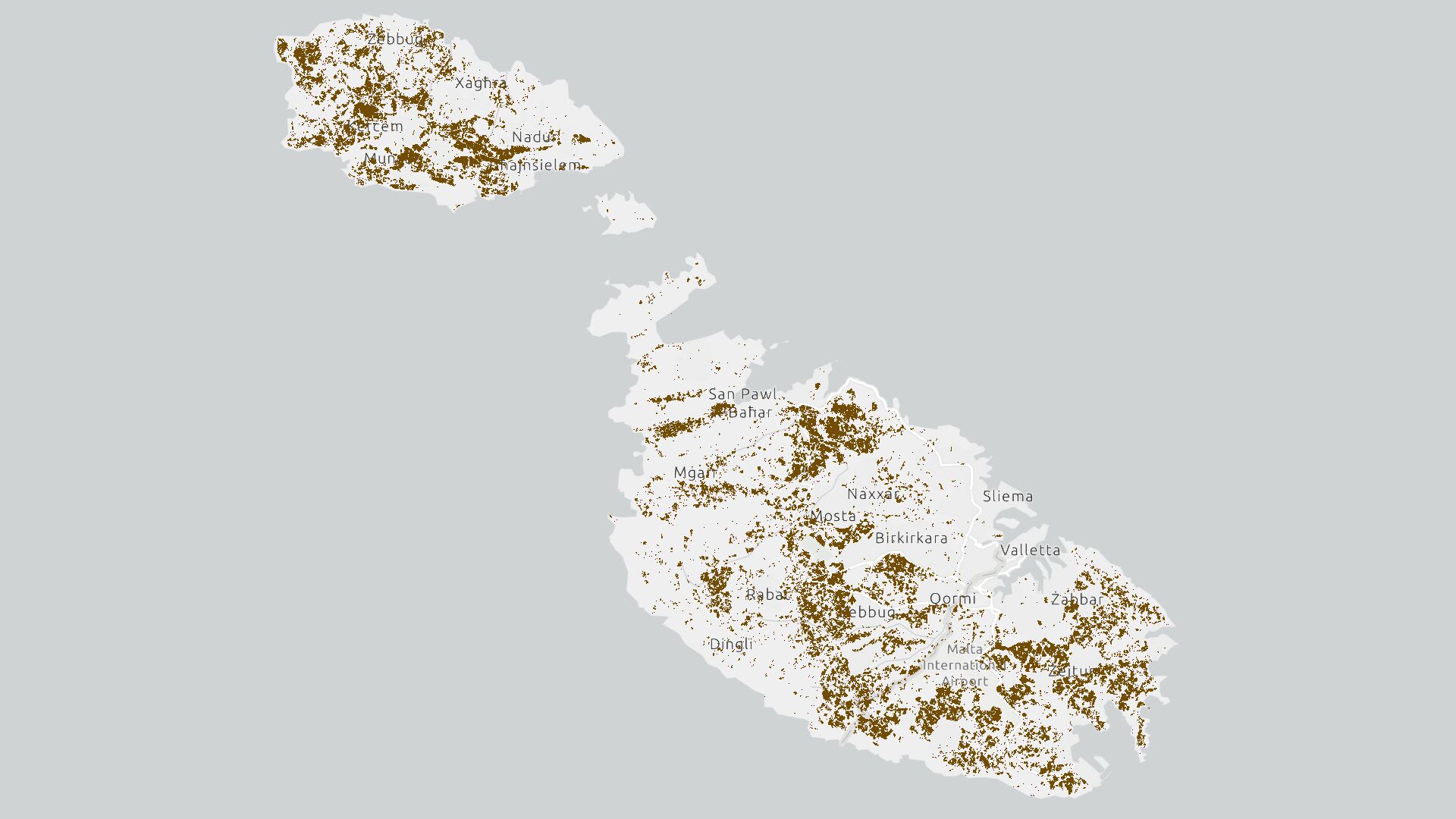
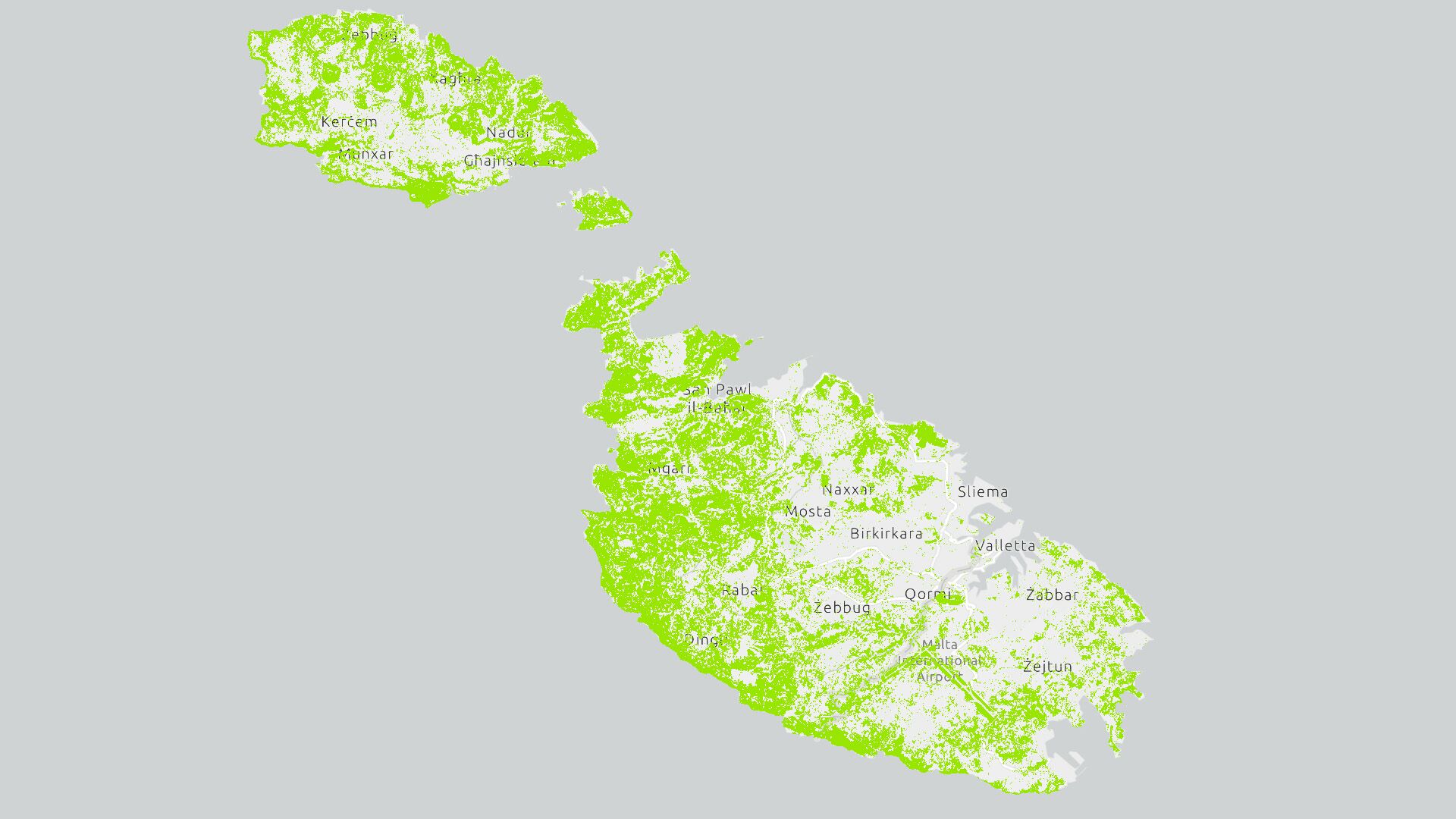
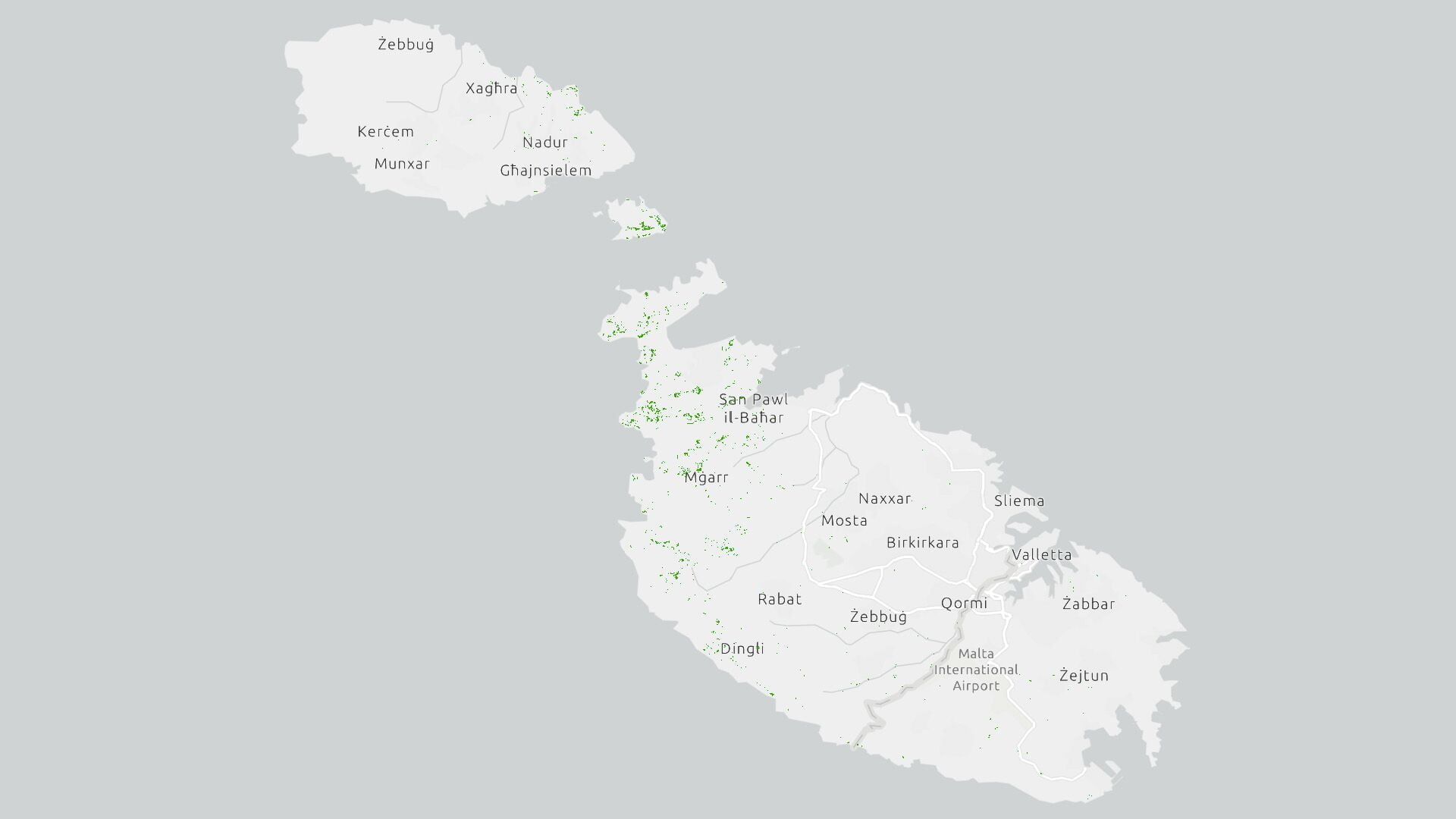
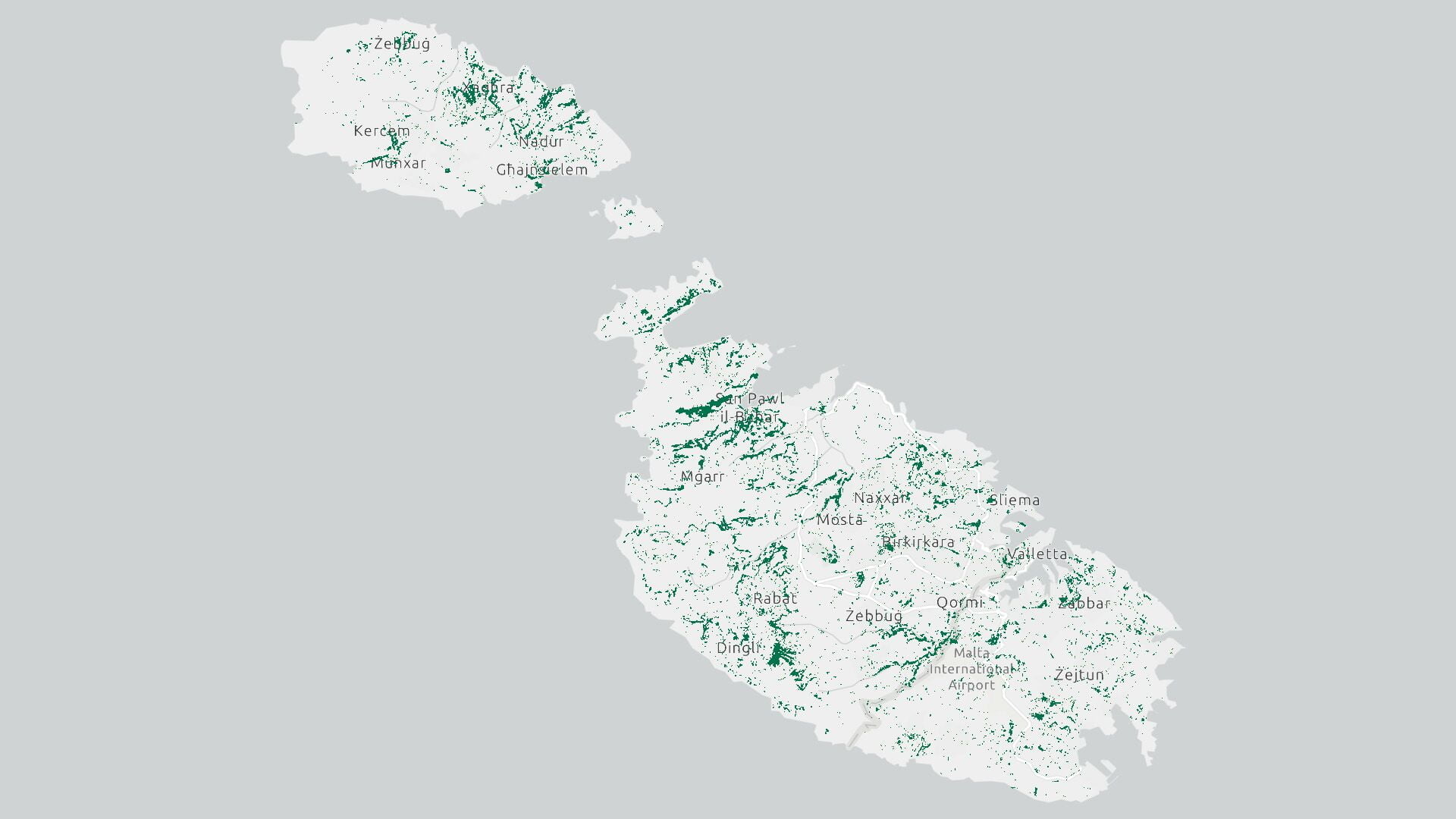
Malta Bare Land Cover 2020

Scope This EPSG:3857 - WGS 84 / Pseudo-Mercator Map processed by the Research Innovation Unit projects the Bare Land Cover for Malta deriving from the European Space Agency (ESA) Worldcover 2020 data product. The ESA WorldCover 2020 product is a yearly median and percentiles composites at 10m resolution, derived from the Copernicus Sentinel-1 and [...]

By |2023-10-31T11:59:27+01:00October 31st, 2023|Geospatial Data, GeoTIFF, Raster Data|0 Comments

Malta Cropland Cover 2020

Scope This EPSG:3857 - WGS 84 / Pseudo-Mercator Map processed by the Research Innovation Unit projects the Cropland Cover for Malta deriving from the European Space Agency (ESA) Worldcover 2020 data product. The ESA WorldCover 2020 product is a yearly median and percentiles composites at 10m resolution, derived from the Copernicus Sentinel-1 and Sentinel-2 [...]

By |2023-10-31T11:47:05+01:00October 31st, 2023|Geospatial Data, GeoTIFF, Raster Data|0 Comments

Malta Grassland Cover 2020

Scope This EPSG:3857 - WGS 84 / Pseudo-Mercator Map processed by the Research Innovation Unit projects the Grassland Cover for Malta deriving from the European Space Agency (ESA) Worldcover 2020 data product. The ESA WorldCover 2020 product is a yearly median and percentiles composites at 10m resolution, derived from the Copernicus Sentinel-1 and Sentinel-2 [...]

By |2023-10-31T11:35:25+01:00October 31st, 2023|Geospatial Data, GeoTIFF, Raster Data|0 Comments

Malta Shrubland Cover 2020

Scope This EPSG:3857 - WGS 84 / Pseudo-Mercator Map processed by the Research Innovation Unit projects the Shrubland Cover for Malta deriving from the European Space Agency (ESA) Worldcover 2020 data product. The ESA WorldCover 2020 product is a yearly median and percentiles composites at 10m resolution, derived from the Copernicus Sentinel-1 and Sentinel-2 [...]

By |2023-10-31T11:23:28+01:00October 31st, 2023|Geospatial Data, GeoTIFF, Raster Data|0 Comments

Malta Tree Canopy Cover 2020

Scope This EPSG:3857 - WGS 84 / Pseudo-Mercator Map processed by the Research Innovation Unit projects the Tree Canopy Cover for Malta deriving from the European Space Agency (ESA) Worldcover 2020 data product. The ESA WorldCover 2020 product is a yearly median and percentiles composites at 10m resolution, derived from the Copernicus Sentinel-1 and [...]

By |2023-10-31T10:51:22+01:00October 31st, 2023|Geospatial Data, GeoTIFF, Raster Data|0 Comments
Go to Top