Geospatial Data
This portal is a collection of accurate geospatial datasets developed by the Research Innovation Unit. In principle these datasets serve as a toolset for researchers, public service, and public sector organisations for the adaption and mitigation of climate change.
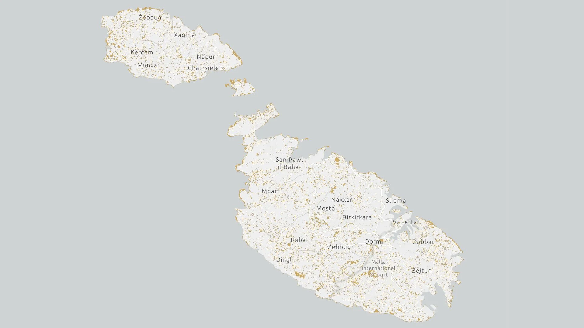
Malta Bare Land Cover 2020
Scope This EPSG:3857 - WGS 84 / Pseudo-Mercator Map processed by the Research Innovation Unit projects the Bare Land Cover for Malta deriving from the European Space Agency (ESA) Worldcover 2020 data product. The ESA WorldCover 2020 product is [...]

Malta Cropland Cover 2020
Scope This EPSG:3857 - WGS 84 / Pseudo-Mercator Map processed by the Research Innovation Unit projects the Cropland Cover for Malta deriving from the European Space Agency (ESA) Worldcover 2020 data product. The ESA WorldCover 2020 product is a [...]
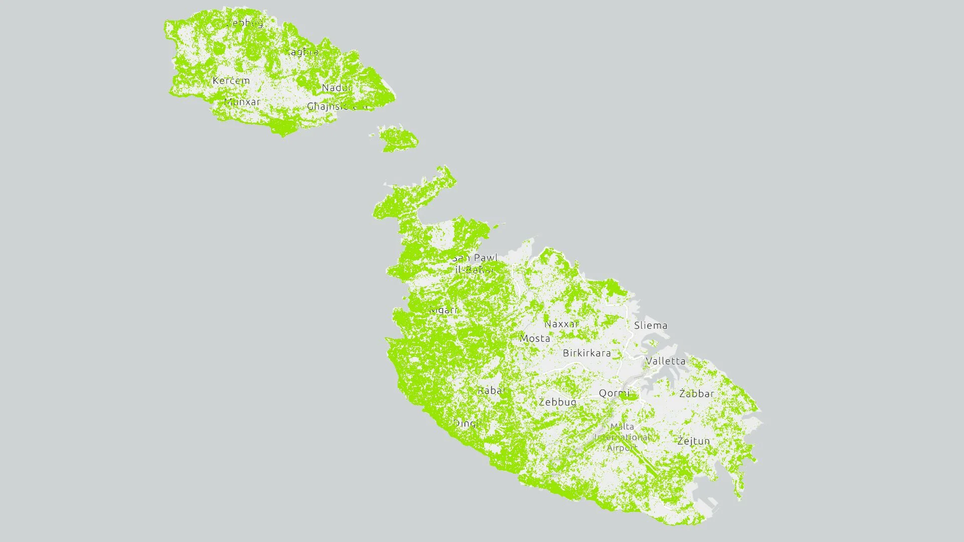
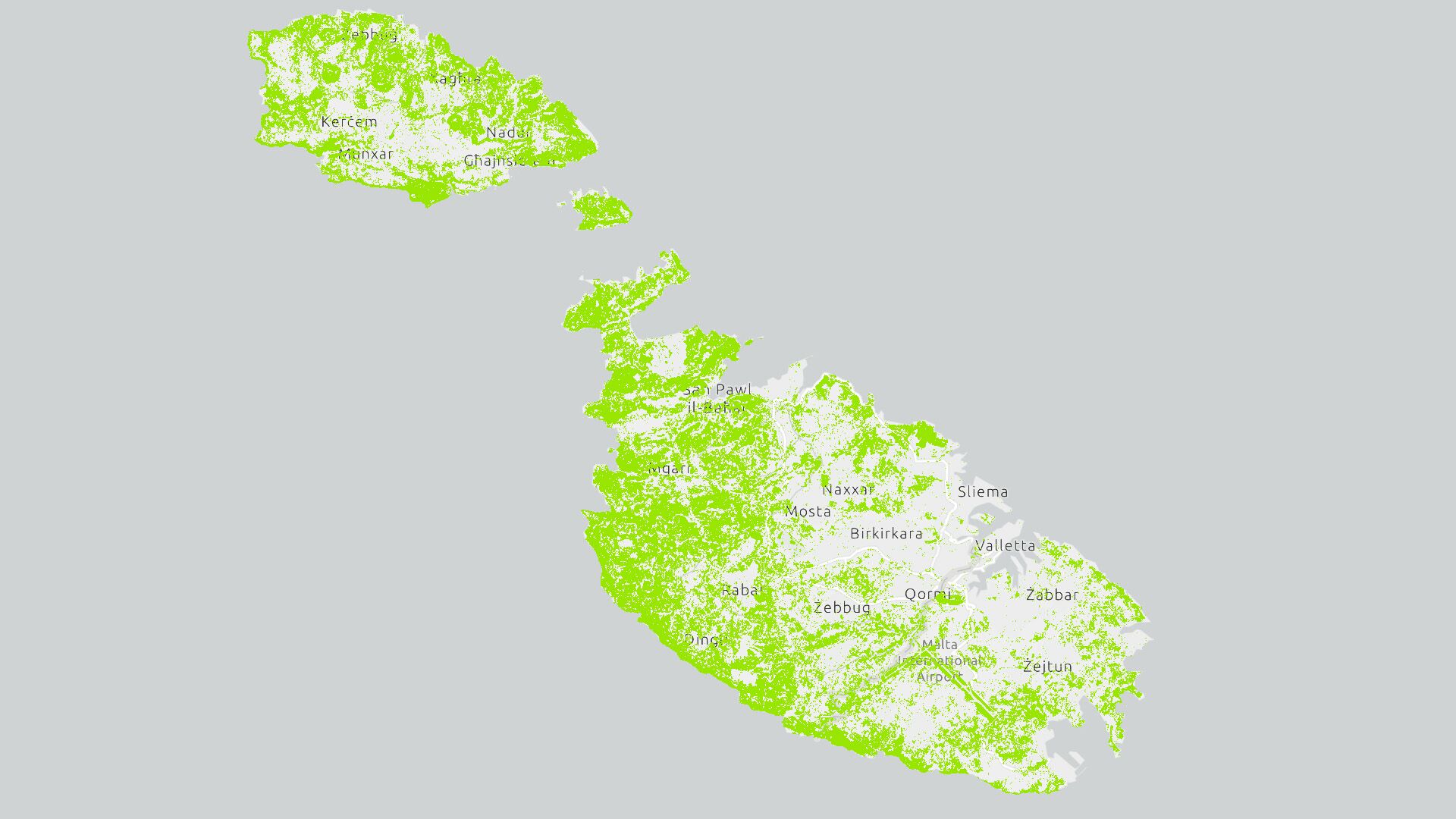
Malta Grassland Cover 2020
Scope This EPSG:3857 - WGS 84 / Pseudo-Mercator Map processed by the Research Innovation Unit projects the Grassland Cover for Malta deriving from the European Space Agency (ESA) Worldcover 2020 data product. The ESA WorldCover 2020 product is a [...]

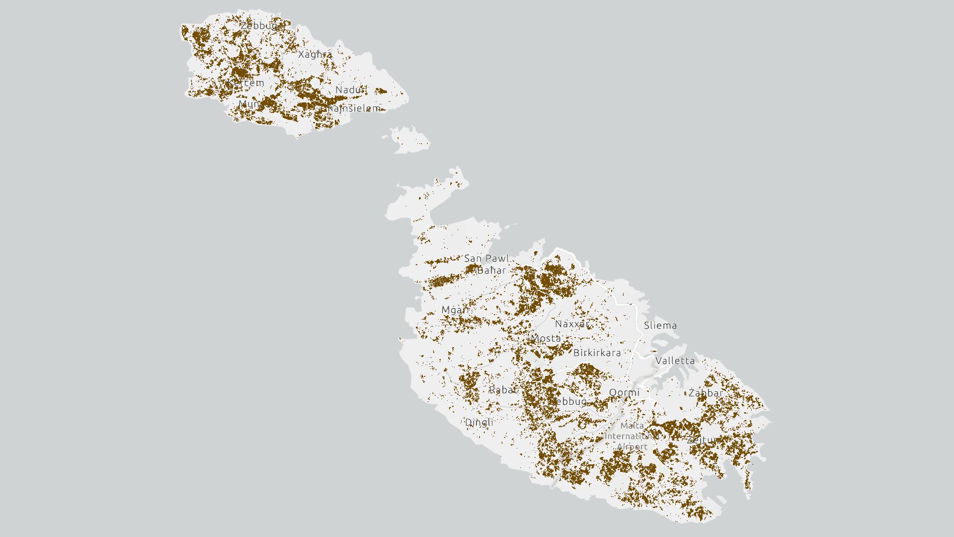
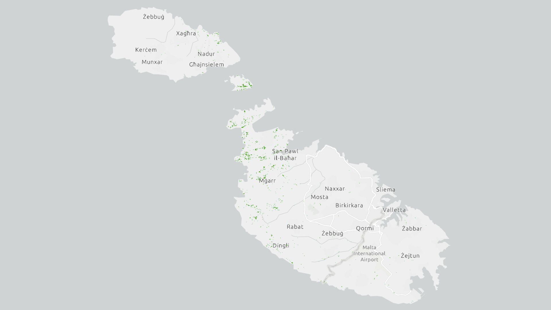
Malta Shrubland Cover 2020
Scope This EPSG:3857 - WGS 84 / Pseudo-Mercator Map processed by the Research Innovation Unit projects the Shrubland Cover for Malta deriving from the European Space Agency (ESA) Worldcover 2020 data product. The ESA WorldCover 2020 product is a [...]

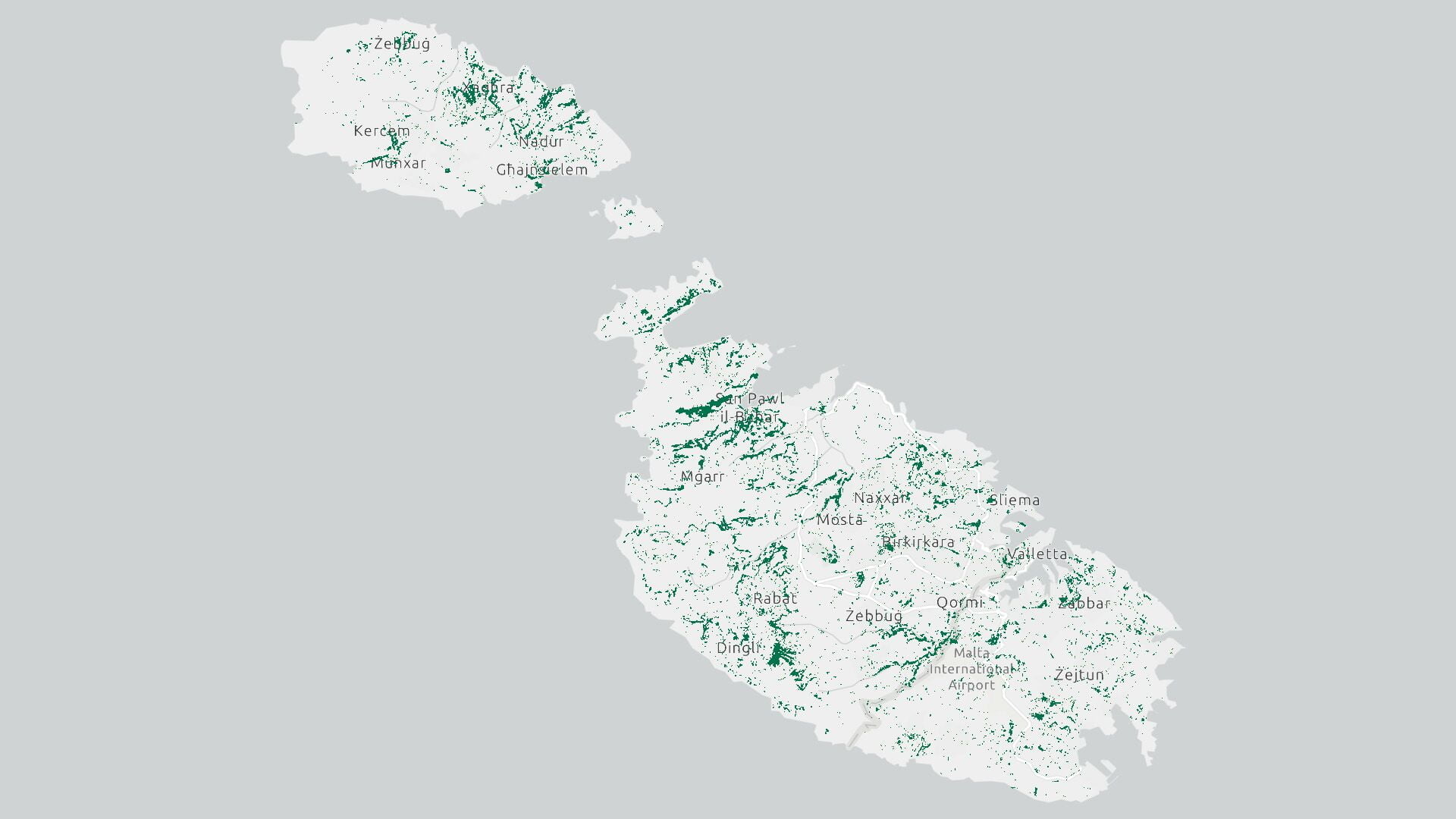
Malta Tree Canopy Cover 2020
Scope This EPSG:3857 - WGS 84 / Pseudo-Mercator Map processed by the Research Innovation Unit projects the Tree Canopy Cover for Malta deriving from the European Space Agency (ESA) Worldcover 2020 data product. The ESA WorldCover 2020 product is [...]
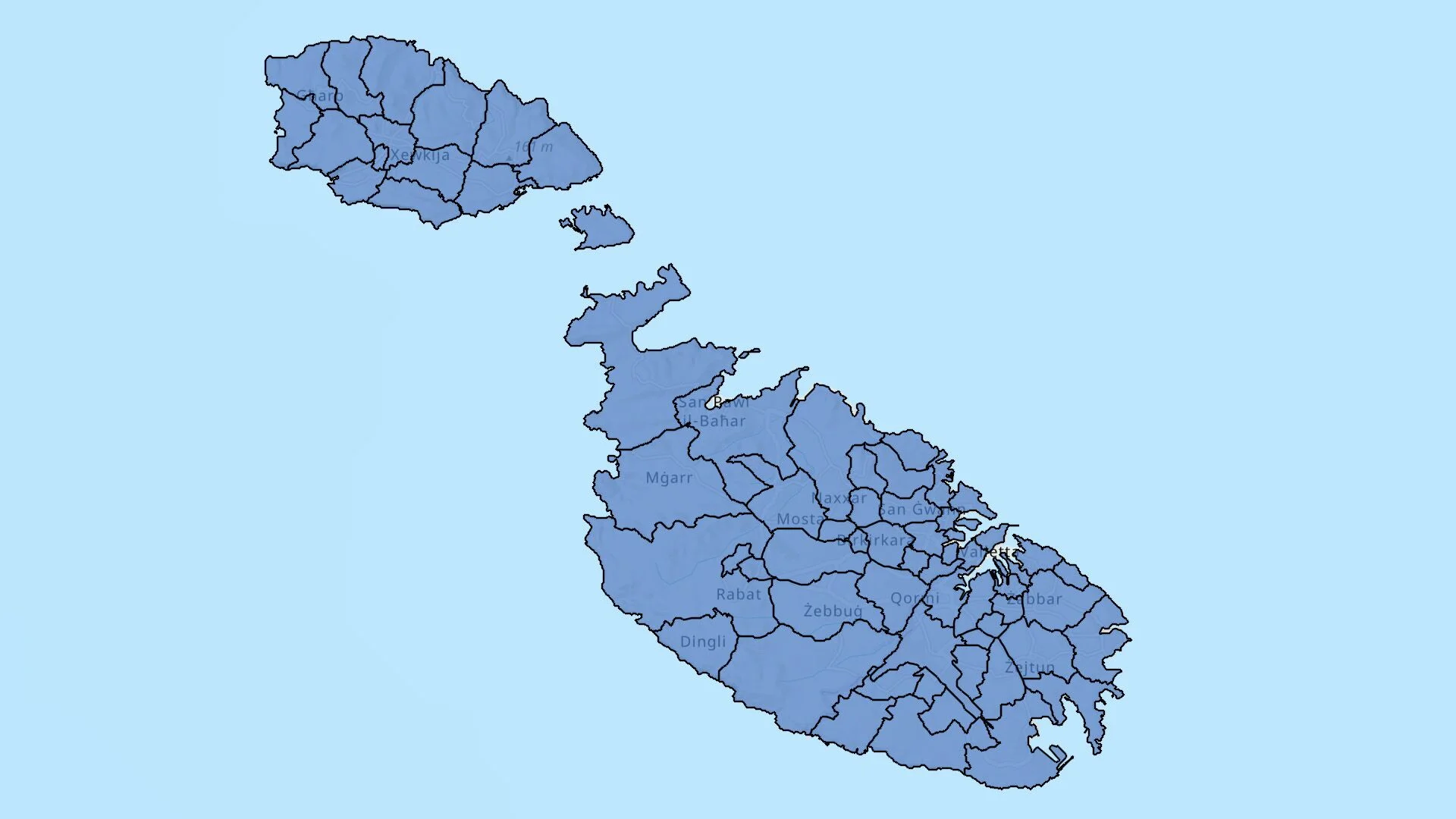
Malta Local and Regional Councils (LAU2)
Scope This EPSG:3857 - WGS 84 / Pseudo-Mercator of Malta is the latest map by the Research Innovation Unit. It is intended to serve as the defacto map for the Maltese Islands consisting of accurate locality numbering, locality names (Maltese and Latin [...]